Where did you ride today?

Rode 2 of the 3 Sisters route in Texas Hill County yesterday. Only 185 miles on the ODO, but I was hot and tired when I got back. It took 70 of those miles just to get from my house to 335.

I left Kerrville on Junction Highway and took 1340 in Hunt, TX to 41. Crossed over 83 on 41 in Mountain Home, TX where Garven Store sits on the corner. Droned passed 336 and went on to 335 which is one of my favorite roads in THC. Hung a left on 335 and enjoyed the twisties and roller coaster hills on the way to Barkdale. There wasn't another soul on 335. I had it all to myself. In Barkdale, I took 55 south to Camp Wood, got some fuel, and headed over to Leakey on 337. Stopped at the Bent Rim to get an Ultra Classic burger, fries, and a Dr. Pepper. Burp. Got back on the bike and headed over to Vanderpool on 337 and then continued on 337 over to Medina. Took a right on 16 in Medina and came on home.

Ran into a million small butterflies on the ride. What a mess. Other than that it was a beautiful and safe ride.
Fantastic. The last time I was down that way was with the Dave Bryson and I was riding VFR . Good memories and a great bit of road.

On the way back Bryson said "let's go by Luckenbach." He's navigating so I say "sure." Then he proceeded to take me down a goat trail that got worse and worse. He was riding a Triumph Tiger and loving the rough stuff but my VFR was many things but it was not a dual sport. The road narrowed to a single track that was punctuated with dry, low water crossings, that were just giant dips where the road vanished for a bit. By the end of the ride my brain was crashing around in my skull. Till this day he has a good laugh when I mention "Luckenbach."
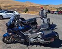
I'm not sure what roads you took to get there since Luckenbach is a far cry from the 3 Sisters route, but it sounds like you must have been on Old No. 9 outside of Comfort that takes you past the bat cave and then had to jog over to Luckenbach on Grapetown Road. There are quite a few roads like those around here. I usually fly down Old No. 9, but I'm used to it.
 
I'm not sure what roads you took to get there since Luckenbach is a far cry from the 3 Sisters route, but it sounds like you must have been on Old No. 9 outside of Comfort that takes you past the bat cave and then had to jog over to Luckenbach on Grapetown Road. There are quite a few roads like those around here. I usually fly down Old No. 9, but I'm used to it.
It was a back road I am sure he found it via Google maps. We were going back to Dallas so it was (sort of) on the way. I was not used to it and at the time I wondered if we were going to end up in a field. All I know is it seemed like we got to Luckenbach by the back way and there was a much faster and more well traveled road in front. Over all it was OK. We listened to some music and bought a T-shirt. You know, the things you are supposed to do there.
 
It was a back road I am sure he found it via Google maps. We were going back to Dallas so it was (sort of) on the way. I was not used to it and at the time I wondered if we were going to end up in a field. All I know is it seemed like we got to Luckenbach by the back way and there was a much faster and more well traveled road in front. Over all it was OK. We listened to some music and bought a T-shirt. You know, the things you are supposed to do there.
Yeh, you took Old No. 9 instead of taking 473 to Sisterdale and going north on 1376 to Luckenbach.
 
Went for ride with Daboo on Tuesday, Visited Rosario Beach and rode through Anacortes, La Conner. Back roads were great and largely empty of cagers. Had great time and a great hosted ride by Chris.
 
I met up with Keith (@motornut ) on Tuesday. It was almost a spur of the moment kind of thing. Both of us are retired, so it meant just clearing a spot on our busy schedules. :D

We headed north on I5 for a few miles and then headed west and north towards the farmlands and coast. The objective was to get to Washington Park in Anacortes, then head south to Rosario Beach.
IitkHbCl.png


We stopped in La Conner at Red Bridge Park. Nice place to get off the bikes and eat a bite of lunch.
yBSWWF6l.jpg


Mandatory motorcycle pic: :D
OKOptOol.jpg


Here's the view from Washington Park.
TsIruqUl.jpg

oijJ6YJl.jpg


We then headed south into those low lying clouds you saw above to Rosario Beach. The low-level haze hadn't burned off here yet.
GRm364ml.jpg

MpFMP3Il.jpg


Overall, it was a great day of riding with great company. :)

Chris
Beautiful. I had to look up where that was since no mention of the State.

How did you do that map? I'd like to be able to plot my rides and post them like that.
 
Beautiful. I had to look up where that was since no mention of the State.

How did you do that map? I'd like to be able to plot my rides and post them like that.
Since it says Google in the bottom I'm pretty sure it's a screen shot of his PC screen with Google Maps open.

Learn how make and save a screen shot of your device with a screen (computer) and you can do the same. I've used an old program called Paint Shop pro for many years on my PC.

The screen shot part is as easy as hit the "print screen" button on a PC keyboard. The rest depends on what you have to save that screen shot and create a picture file.
 
I'm using the built-in screen capture app on Windows 11 Home right now. Another that is really good, is Greenshot. https://getgreenshot.org/

In both, you hit the Prt-Scn key and you can select a portion of the screen to capture. From there, you can paste it into your browser or save it for later.

As for the state, it is Washington State, on the "left" coast. ;)

Chris
 
Rode 2 of the 3 Sisters route in Texas Hill County yesterday. Only 185 miles on the ODO, but I was hot and tired when I got back. It took 70 of those miles just to get from my house to 335.

I left Kerrville on Junction Highway and took 1340 in Hunt, TX to 41. Crossed over 83 on 41 in Mountain Home, TX where Garven Store sits on the corner. Droned passed 336 and went on to 335 which is one of my favorite roads in THC. Hung a left on 335 and enjoyed the twisties and roller coaster hills on the way to Barkdale. There wasn't another soul on 335. I had it all to myself. In Barkdale, I took 55 south to Camp Wood, got some fuel, and headed over to Leakey on 337. Stopped at the Bent Rim to get an Ultra Classic burger, fries, and a Dr. Pepper. Burp. Got back on the bike and headed over to Vanderpool on 337 and then continued on 337 over to Medina. Took a right on 16 in Medina and came on home.

Ran into a million small butterflies on the ride. What a mess. Other than that it was a beautiful and safe ride.

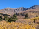
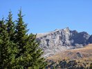
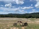
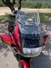
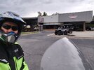
IMG_6482.JPGIMG_6487.JPGIMG_6490.JPGIMG_6494.JPG


Memories of my days living in Wichita Falls and riding the Sisters, in the Hill Country, on a three day weekend. Great riding in the late fall.
 
Since it says Google in the bottom I'm pretty sure it's a screen shot of his PC screen with Google Maps open.

Learn how make and save a screen shot of your device with a screen (computer) and you can do the same. I've used an old program called Paint Shop pro for many years on my PC.

The screen shot part is as easy as hit the "print screen" button on a PC keyboard. The rest depends on what you have to save that screen shot and create a picture file.
I'm using the built-in screen capture app on Windows 11 Home right now. Another that is really good, is Greenshot. https://getgreenshot.org/

In both, you hit the Prt-Scn key and you can select a portion of the screen to capture. From there, you can paste it into your browser or save it for later.

As for the state, it is Washington State, on the "left" coast. ;)

Chris
In Windows 10 Home, I get screenshots using the Windows key and PrtSc key together. The screenshots go into a folder named "Screenshots". I then can mark them up with a graphics program. I guess I could use my Intuos tablet and pen for more accuracy with the roads.

A buddy of mine showed me a way to map out all the routes without screenshots but I don't remember how he did it. He has all the routes he's driven mapped out. I'll have to get with him again and see how he does it.
 
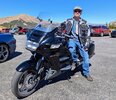
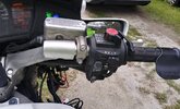
I rode to Ron Ayers today to finally get me a Crampbuster. I purchased the wide version. I am really pleased with it so far. Helps relieve some of the pressure off your grip on longer rides. Between that and the Go-Cruise it definitely makes riding longer easier.
 

Attachments

  • 20240926_162920_HDR.jpg
    20240926_162920_HDR.jpg
    126.8 KB · Views: 18
  • 20240926_173820_HDR(1).jpg
    20240926_173820_HDR(1).jpg
    127.1 KB · Views: 17
Chris's screenshot kind of looks like what you get when building a route in Google my maps.
 
Ah yeah I meant record the route in the map app like Daboo did in the beginning of his post,as I usually don't plan where I am going. I do know how to video , pretty simple on the phone .
 
Back
Top Bottom