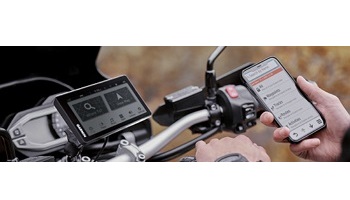
Zumo 595LM, iPhone and Sena SMH10R

skipcurt

Skip
Joined
May 23, 2009
Messages
765
Location
Woodstock, GA
Bike
'18 BMW R1200 GSA
I just installed my brand new 595LM earlier this week and I really must say that thing is the biggest pain in the a** gps I've ever used. I came from a Nuvi and I have created 100+ routes without an issue using MyRouteApp (MRA). I have been PM'ing with JFHeath and he has given me some great information about route creation.
  • I have created a very simple 6 turn, 10 mile, 20 minute ride with 7 waypoints. 1 is the start and 7 is the end.
  • I have downloaded the Garmin Smartlink app.
  • I have downloaded BaseCamp.
  • My iphone and Sena are both paired with the Zumo.
  • I have saved the GPX file as "new" and also as "old" in MRA. New gives you just beginning and end. Old gives you all the waypoints.
  • My previous experience is with having all the waypoints.

I start off the ride and it does not tell me to turn right onto the yellow road (92). It does warn me for the upcoming right turn (2) and also tells me to turn right at (2). Again it does warn for the upcoming right turn (3) and tells me to turn right (3). From there on out not one single verbal direction. It has done this for both old and new type files. The magenta route line also is not directly on the road that I am travelling on. It wants to make more of a straight line than following the flow of the road.
I have also viewed a Youtube video titled "How to create a route for Garmin Satnav using Tyre". Tyre became MRA. It directs you to import your gpx file into BaseCamp and "re-calculate" and it will correct it. It does but I get the same results as above.

On the phone my contact list is available so I choose a person to call. Hit the call button but never hear a ring and then it disconnects. Repeat the command to a different number with the same result.

Go to media player to play some music that I loaded on SIM card. I see the folders and find a song and hit play. It is playing (I can see the counter changing) but I can't hear it.

REALLY?? Does it have to be this difficult? I know it's new and there's some learning I have to do but come on. I am seriously this close (picture two fingers really close together) to removing this and going right back to the Nuvi.

Skip
 

Attachments

  • Zumo.JPG
    Zumo.JPG
    62.6 KB · Views: 10
Hi Skip:

I have a 595, and it is problem-free. I suspect that the problems you are having are configuration issues that can be easily fixed.

First, in Basecamp, when you create the route, be sure you are creating the route using the "motorcycle" profile, and be sure that the default routing for the motorcycle profile is not set to "off-road" (which would account for the magenta line not following the road). Also check the configuration (settings) of the Zumo itself to ensure that "off-road" is not selected as the preferred routing.

Next, check to make sure you have the same version of maps on both your computer and the device. Use Garmin Express to download the maps. On the Garmin Express page that shows you the map version number and the GPS software version number, click the blue text "Map Options" and ensure that you select maps to be downloaded to both your computer and your GPS.

Once you have downloaded the most up-to-date map, go to the control panel of your computer, select "Programs & Features", and remove any Garmin maps that may exist other than the most recent version that you just downloaded.

Lastly, when you send a route to your GPS from Basecamp, go to the "Trip Planner" icon on the GPS and import the route from the Trip Planner.

Hopefully the above-mentioned actions will get you back onto the yellow brick road to happiness (magenta brick road, perhaps?). :)

Michael
 
Hi Skip:

I have a 595, and it is problem-free. I suspect that the problems you are having are configuration issues that can be easily fixed.

First, in Basecamp, when you create the route, be sure you are creating the route using the "motorcycle" profile, and be sure that the default routing for the motorcycle profile is not set to "off-road" (which would account for the magenta line not following the road). Also check the configuration (settings) of the Zumo itself to ensure that "off-road" is not selected as the preferred routing.

My profile in BaseCamp under Edit/OptionsActivity Profile is motorcycling and in the Routing tab it's set at Faster Time, Road Avoidances has Unpaved Roads checked and Feature Type Avoidances has them all checked except Toll Roads and Roundabouts. The Zumo is set at Faster Time only and the other 3 are unchecked. Zumo avoidances has all checked except Highways.
I am not creating it in BaseCamp, I am creating it in MyRouteApp and either exporting to my device from MRA or importing it into BaseCamp and then exporting to my device. Neither method has worked well yet. I can't figure that software out. It is so complex compared to MRA. I can't even figure out how to clear the route I'm working on to start a fresh one.


Next, check to make sure you have the same version of maps on both your computer and the device. Use Garmin Express to download the maps. On the Garmin Express page that shows you the map version number and the GPS software version number, click the blue text "Map Options" and ensure that you select maps to be downloaded to both your computer and your GPS.

My PC has the Garmin North America NT 2020.10 maps but the Zumo has (3) CN North America NT 2020.10 Foursquare, North America DEM & CN North America NT 2020.10 ALL. Those are the exact names and all 3 are checked. Do I uncheck all but the ALL file? Will they stay off permanently?

Once you have downloaded the most up-to-date map, go to the control panel of your computer, select "Programs & Features", and remove any Garmin maps that may exist other than the most recent version that you just downloaded.

There was only the one set of maps in there. The Garmin North America NT 2020.10

Lastly, when you send a route to your GPS from Basecamp, go to the "Trip Planner" icon on the GPS and import the route from the Trip Planner.

That is what I did.

Hopefully the above-mentioned actions will get you back onto the yellow brick road to happiness (magenta brick road, perhaps?). :)

Michael
So it seems to me that everything is inline except for maybe the map differences. Really hard to believe that you have to be a computer engineer to create a route for the Zumo. If my choice is to learn Basecamp or go back to the Nuvi...I will go back to the Nuvi.

Skip
 
I also followed the steps on this video from the MRA folks explaining the entire process of correctly transferring the route from MRA to the Zumo. It's fairly long so the transfer process starts around 14:00. When I go to my mobile MRA app and get my route and save it to the Garmin Smart Link app I get the pop up message "File Sharing Not Supported. Your navigator doesn't support file sharing functionality. Connect a compatible navigator to share the file". I don't know what that means other than I can't transfer the file or even how to fix or change the problem. Another strikeout.

Skip
 
Hi Skip:

The map difference alone (different maps on your PC and your Zumo) will screw things up royally - if the maps are not identical (meaning, same version number) on both devices, the route will always be recalculated when it is downloaded to the GPS device. This behavior has existed for the past 20 years, it's not new, but it is the most common problem that trips people up.

As for Basecamp - it's not as bad as it looks, and the transition from MapSource to Basecamp is not difficult, although it is not intuitive.

The problem people run into when transitioning from MapSource to Basecamp - and I admit I encountered the same "wall" when I first started to use Basecamp - is that the two programs take totally different approaches to how data is stored.

MapSource is a very simple program. You create a route (or upload data from your GPS) and then save the file, and all that the file has in it is whatever you created or uploaded. You can have many, many different files, each containing a different set of routes and/or a different bunch of track uploads from your device. Think of MapSource as being like Microsoft Word: each time you create a document in Word, it is saved as a unique, standalone file.

Basecamp, on the other hand, only maintains one "file", and that file is not obvious to the user. So, what we have to do is recognize the different paradigm used by Basecamp, and once we wrap our heads around that, everything becomes a lot clearer. Think of Basecamp as being like Microsoft Outlook (the email program) - you don't have a different file for each email, instead, all of the emails you have sent and received are all stored in one giant file, and when you open the Outlook program, you can navigate around and find all your past emails. Some people choose to "organize" their Outlook data file into different folders, such as work, personal, the boss, the wife, etc. The same concept - you can organize stuff into folders - exists in Basecamp.

Below is a screenshot of the Basecamp application on my computer. I've been using it for about 5 years, although it has about 12 years of data in it (I imported a bunch of my historical MapSource files). I own two different GPS devices, a 660 I use in Europe on the ST 1100 and a 590 I use in North America on the ST 1300.

If you look on the left side, you will see folders. I have folders for planning, folders for data uploads (track uploads) from the two devices, and folders for lists of waypoints. Within each folder you will see "lists". For example, look at the 2019 Planning folder. It has lists for routes I plan to ride in Europe in two weeks, for the Georgia rally in Suches last month, and for Morocco when I rode there in February.

Note that the "Georgia Spring Rally" list is highlighted in light grey. You can see the contents of that list in the lower left, and the map itself shows what is in that list - a bunch of waypoints as well as the routes and tracks that Michael, the rally organizer, sent out to us.

Comprehending the use of folders to hold lists - wrapping your head around that concept - is 99% of the work involved in transitioning from MapSource to Basecamp. Once you have that figured out, it's super-easy to use Basecamp to create routes, because they are created pretty much the same way we created them in MapSource. You set an origin & destination, and then you customize your route either by inserting waypoints you have created into the route, or by right-clicking on the route line (in the map) and selecting "Insert into Route" from the drop-down context menu. Then you rubber-band the route the way you want it, same as in MapSource.

BaseCamp Folder & List Organization
239962


To transfer the routes from Basecamp to your GPS, or to upload track data (and/or waypoints) from your GPS, you plug the GPS into the computer and it will appear way down at the bottom of the folder list (see picture below).

Where the Zumo appears when you plug it in
239963


Uploading of tracks from the GPS will take place automatically when you plug it in - the tracks will appear under the "Data Received from..." folder. To avoid having dozens of different upload listings each year, I create one new "List" each year with the year on it (for example, 2019 NAR, where NAR is my abbreviation for North American Region), and when I do an upload from the GPS, I use the "send" command to send all the uploaded tracks to the current year's list. Then I delete the daily upload that was just created when I plugged in the GPS.

To send stuff to the GPS (routes, or waypoints, or both), once you have plugged the GPS into the computer, you go to the list containing whatever you want to send to the device, select the item (a route or waypoint, or multiple routes or waypoints), then right-click and choose "Send to" from the drop-down menu. You then select the GPS device as the target where you want to send the data, and voila, it transfers.

Once you have sent the new data (routes or waypoints) to the GPS, you then go to the "Trip Planner" app within the GPS device and "import" the routes for use.

If you know someone who is familiar with Basecamp, spend about 20 minutes with them. Once you see how the application is used - in other words, once you recognize that the whole data storage concept is different that MapSource and you stop expecting it to act like MapSource - it then becomes a pretty simple program to use, and quite a useful and powerful program.

You mentioned that you use a third-party (non-Garmin) application called MRA. I don't know anything about this, so, I can't comment on it. I have only ever used MapSource and Basecamp.

Michael
 
Hi Skip-

I'm as new to the Zumo and BaseCamp as you; I'm definitely still in "learn" mode also. I've used Tyre for a while, though I never made the transition to MyRouteApp.

Recently I discovered that "shaping points" (aka "Via Points") can be set to alert on arrival, or not. Perhaps that's what's causing your unit to not announce certain turns?

239967
 
Hang there Skip. Four or five rides into my new 396 it's become easier to use than the 550 and I know the settings to check if music or directions aren't coming to the Sena.
 
Stick with it Skip. I run a 590 and use BC and it works real well. Update your maps on the GPS AND your computer and you'll be good to go.
 
Skip,

On the issues of not hearing your phone, make a call while looking at your phone screen to make sure the audio says Sena. It’s the call screen on the phone where you can select speaker phone, except you have the option of selecting the Sena headset. Sometimes the phone will remember the settings, sometimes not. I always check the settings by making a call, before I take off.

John
 
Post # 2 CYYJ (Michael) responded:

First, in Basecamp, when you create the route, be sure you are creating the route using the "motorcycle" profile, and be sure that the default routing for the motorcycle profile is not set to "off-road" (which would account for the magenta line not following the road). Also check the configuration (settings) of the Zumo itself to ensure that "off-road" is not selected as the preferred routing.

My profile in BaseCamp under Edit/OptionsActivity Profile is motorcycling and in the Routing tab it's set at Faster Time, Road Avoidances has Unpaved Roads checked and Feature Type Avoidances has them all checked except Toll Roads and Roundabouts. The Zumo is set at Faster Time only and the other 3 are unchecked. Zumo avoidances has all checked except Highways.
I am not creating it in BaseCamp, I am creating it in MyRouteApp and either exporting to my device from MRA or importing it into BaseCamp and then exporting to my device. Neither method has worked well yet. I can't figure that software out. It is so complex compared to MRA. I can't even figure out how to clear the route I'm working on to start a fresh one.


Next, check to make sure you have the same version of maps on both your computer and the device. Use Garmin Express to download the maps. On the Garmin Express page that shows you the map version number and the GPS software version number, click the blue text "Map Options" and ensure that you select maps to be downloaded to both your computer and your GPS.

My PC has the Garmin North America NT 2020.10 maps but the Zumo has (3) CN North America NT 2020.10 Foursquare, North America DEM & CN North America NT 2020.10 ALL. Those are the exact names and all 3 are checked. Do I uncheck all but the ALL file? Will they stay off permanently?

Once you have downloaded the most up-to-date map, go to the control panel of your computer, select "Programs & Features", and remove any Garmin maps that may exist other than the most recent version that you just downloaded.

There was only the one set of maps in there. The Garmin North America NT 2020.10

Lastly, when you send a route to your GPS from Basecamp, go to the "Trip Planner" icon on the GPS and import the route from the Trip Planner.

That is what I did.

I'm guessing folks didn't see my actual responses to CYYJ because they were buried inside the quote. That's why I just did what I did. Today I will re-pair my units to see if that solves the music & phone problem. Then I only have to work on the routing issues. I would like to have the feedback on which maps to toss though.
 
Hi Skip-

I'm as new to the Zumo and BaseCamp as you; I'm definitely still in "learn" mode also. I've used Tyre for a while, though I never made the transition to MyRouteApp.

Recently I discovered that "shaping points" (aka "Via Points") can be set to alert on arrival, or not. Perhaps that's what's causing your unit to not announce certain turns?
I did see that within Basecamp Keith and I did change them all to notify before exporting to the gps.
 
I just went to un-pair and re-pair my units. I deleted the devices off my iphone and then I restored the gps bluetooth section to factory. I followed this site even though it's from down under. After pairing the Sena first, then the phone I attempted to listen to mp3 music on a SIM card to my Sena. I can hear the gps making a clicking noise when I press buttons and it even stated something about gps lost reception but no music. Swing and a miss!
 
When you go to the music player does it show a list of your music files?
 
When you go to the music player does it show a list of your music files?
Yep. I started small and just added two complete albums. I can pick from Artist, Song etc. The music is playing because I see the counter counting and I can pause it. Just can't hear it.
 
Yep. I started small and just added two complete albums. I can pick from Artist, Song etc. The music is playing because I see the counter counting and I can pause it. Just can't hear it.
Obvious question but did you turn the sena volume up? Sorry, but just eliminating stuff.

So now, what does your bluetooth screen look like, should look like this:
239971
 
I just went to un-pair and re-pair my units. I deleted the devices off my iphone and then I restored the gps bluetooth section to factory. I followed this site even though it's from down under. After pairing the Sena first, then the phone I attempted to listen to mp3 music on a SIM card to my Sena. I can hear the gps making a clicking noise when I press buttons and it even stated something about gps lost reception but no music. Swing and a miss!

Hmm I am going to have to try that site. I have had nothing but problems with my Zumo 595 - Sena 20S - Samsung Note 9 combo.


Part of me was wondering if it works better with an iPhone.

Most recently I added music to a SD card and put it in the 595 but it doesn't see it. Right now I have been either just listening to the radio on my 20S or direct pair to my phone and play the stuff from the phone and skipping the audio on the GPS all together. I can mount my phone in the RAM X-Mount on the dash for caller ID and that seems to work fine but I miss having that Bluetooth Hub aspect that I had with my Zumo 550. I do still have it on the bike so I could go back to pairing with that.

Another tip with the 595 is that a lot of people complain about readability in daylight. Even with the brightness cranked all the way up it is not nearly as bright as my 550.

I loaded this theme for it and it helped.


There is also a lot of general good info and tips here.

 
Obvious question but did you turn the sena volume up? Sorry, but just eliminating stuff.

So now, what does your bluetooth screen look like, should look like this:
The volume is turned up. Here is my screen. I see that the music icon is not orange but yet the Sena is paired. How is that?
 

Attachments

  • IMG_4638.JPG
    IMG_4638.JPG
    97.7 KB · Views: 26
I can't even figure out how to clear the route I'm working on to start a fresh one.

Click on it and hit Delete. You can click on either the map visualization or the list item. Then click the New Route button on the toolbar to start again.

As a Tyre user I am used to defining routes from a point of origin and gradually extending them turn by turn until I reach a destination. In BaseCamp it seems easier to set both endpoints then drag segments to reshape the route. Click the route and hold the Alt key while dragging, to add via points.

Panning the map while doing this is a PITA.

@CYYJ or @jfheath, what's the difference between a route and a track? Which should I choose to export, when creating shareable. gpx files for use by other people or on my other devices?
 
The volume is turned up. Here is my screen. I see that the music icon is not orange but yet the Sena is paired. How is that?
The music tone needs to be off on your phone connection and on for the sena which is why you can't hear music... I don't know if both can be on but on mine, it's just the sena
 
Anyone now how to do that? All I did was pair them. It didn't ask about specifics. This is freakin ridiculous!
 
Back
Top Bottom