New Garmin Zumo XT

And what would they gain from it? Just to see where you're riding :)
Soon your satnav will feature popup adds suggesting zis and zat food-joint, service station, "special offers", etc... along your way...
Google Maps is already starting... big $$$ for them...
Shopping for micro SD card for the XT- any advice on storage size from the experts?
A high quality (Class 10 & up) 8GB seems ideal, the kits still run the FAT32 format, due the 4GB file limit, larger maps will be split...
 
Soon your satnav will feature popup adds suggesting zis and zat food-joint, service station, "special offers", etc... along your way...
Google Maps is already starting... big $$$ for them...
Ah, but Google don't charge for their services.

Just wait for the time when over a period of months your photographs slowly develop an advert across the bottom of the picture, linked to the websites that you have been visiting. That will add a bit more interest to the wedding albums of the future.

No - hang on - don't read that until I have patented the idea.
 
Soon your satnav will feature popup adds suggesting zis and zat food-joint, service station, "special offers", etc... along your way...
Google Maps is already starting... big $$$ for them...

A high quality (Class 10 & up) 8GB seems ideal, the kits still run the FAT32 format, due the 4GB file limit, larger maps will be split...

You were saying.
 
Ah, but Google don't charge for their services.
Nah, they only collect and sell your data...
You were saying.
I remember Garmin having a similar concept in the pipeline...
This (as well as North Star & E-Call tracing) is a definite case for ripping out the wire cutters...
 
Well I went shopping and ended up going to Walmart and for some reason got the 128GB for about $20 and put it in the zumo XT.
I was going to get the smaller one 64 GB but it was almost as much.
So -- I loaded 4 upcoming routes I had in basecamp and it went from 127.6 GB available to 119 GB ?? 8 GB used. So about 2 GB per route- Does that sound about right? Seems high to me.
The routes only have about 5 way points and are between 380-450 miles each.
 
Sound like mine is totally whacked out on the file size for these routes.
It almost seems like it is storing the entire city navigator 2022 map each time I save a route?
Any suggestions on what I may be doing incorrectly?

In basecamp I select " transfer route" to device and select the Zumo XT memory card and it does its thing. Fairly straight forward but something is not right.
 
The number of points that you plot has very little to do with the file size, because Basecamp transmits thousands of invisible intermediate points. This is so that when the Zumo receives it, no matter what the Zumo settings, it reproduces exactly the route that Basecamp sent. It has to - the points are so very close together. The Zumo should not spend a long time calculating the route when it is transferred or imported. A few seconds, thats all. Any longer and there is something wrong with your settings.

The Zumo only strays from that original Basecamp route if you allow it to recalculate - eg by having mis-matched maps on Basecamp and the Zumo; by having the wrong settings in Basecamp's transfer options; by pressing skip; by wandering off route.

I have just plotted a 1200 mile route from one end of the UK to the other. The GPX file exported from Basecamp has nearly 20,000 points, although I placed only 10 Via Points and Shaping Points to form the route. That is normal for a Basecamp route of that length.

However the total file size is 1.5MB

I have a 32GB SD Card, but after formatting, the card has only 29.7GB of space available. The filing structure occupies a fair amount of space. Like those multivolume encyclopaedias - the last volume was full of the index. Also Garmin will have taken up a bit of space, but not much. Files always take up much more space than they actually require, but again 8GB is a lot.

What size does it say the file is on the memory card in the Garmin/GPX folder ? That would give a better indication of the actual file size.
 
This is what I am getting when I check the properties on both the XT and the memory card.
It is showing nothing on the card but I know I have at least 4 routes on the card because I transferred them there myself.
The last pic shows the garmin express information. They are all different??
I did a total reboot of my XT and still shows the same memory data?
 

Attachments

  • 1622058614078.png
    1622058614078.png
    32.6 KB · Views: 15
  • 1622058781574.png
    1622058781574.png
    6 KB · Views: 17
  • 1622058880112.png
    1622058880112.png
    50.5 KB · Views: 14
  • 1622061216026.png
    1622061216026.png
    9.6 KB · Views: 10
Last edited:
What size does it say the file is on the memory card in the Garmin/GPX folder ? That would give a better indication of the actual file size.
( 1.45MB) Here is the file sizes on the card - they seem to be in KB but can't explain what is going on with the data discrepancies
 

Attachments

  • 1622061590954.png
    1622061590954.png
    21.8 KB · Views: 10
Last edited:
I am just beginning to play with Basecamp so have limited familiarity.
Where does one see this information?

Regarding the number of invisible points ? Basecamp does't give that information - but a gpx file is just text so it will load into a text editor, so you can see why it is very much larger than just your 5 route points. But not by 2 Gb.

Long answer. Its a bit overwhelming to decipher at first, but the invisible 'ghost' points are the ones that begin with <gpxx when viewed in a text editor.
However, to get a more instant count - I dropped my gpx file into an Excel spreadsheet and let it interpret it as an XML table. Each point occupies one row of the table, go to the end of the sheet (crtl / end) and see the row number for the approximate point count.

Short answer. in basecamp, select the route, right click on it to open a menu and choose the option to make a track. Zoom in to a section of the track and notice those little dots. Those dots have been created from the invisible route points that were in the route.

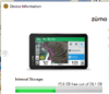
Regarding the discrepancy. Ive never had a 128Gb card. But my out of date knowledge expects small files to take a disproportionate amount of space. But not 2gb.

I know that Windows does not update its file info immediately. I sometimes have to close file explorer and open it up again - or display the contents of another folder and then switch back to show recent changes.

I'd be tempted to find a large file of around 2gb - a video or a pdf, and see how many times it will copy to the SD card, or copy the contents of a folder from your hard disk. Just set it off and leave it. See how much it copies, and compare with how much space the files take on both devices. There will be some difference but not a massive amount. I'm wondering if you have a rogue card.
 
Last edited:
Alright, Garmin Express 7.6.0.0 is released/ready for download, folks report that local (PC) map installation is functional* again...
(* also other devices like the Montana were struck by the "malfunction" of map installation options...)
 
Thanks for info- are you going to report the hang up to Garmin?
They (members on German forum) escalating the issue quite well... ;)
(I don't have an XT nor would I use BaseCamp; my unit & software origin from an era where they still had quality control in place... :cool:)
It appears that the current Garmin Express version is writing the *.gma files into the wrong directory...
Quite a disgrace for a big corporation that users have to debug the stuff... :rolleyes:

 
I think they fixed it :wave1:....I just checked and now it has an option to "Install map to computer"- This (option) was not there the other day.
The only thing on this page before today was to "Reinstall Map"

1622393892946.png
 
Tested the Zumo XT Incident alert today!

But not on my bike!

I am currently touring Iceland in a rented Land Cruiser. Was being a bit too adventurous driving on the 4x4 road from Stong to Haifoss and hit a large hole rather hard. Before Kathy could complain, the Zumo XT told me that it had detected an “Incident” and showed me where the closest vehicle repair / tow shop was.

I cancelled the alert and continued through all the deepest puddles!

I decided not to try and stimulate this alert on my bike!
 
That was one of the first features I deactivated. It sounds like a great idea, but you could have it automatically dial your spouse without you realizing it at first, all because you did a stop-n-drop.

Chris
 
I don't usually , no, I really never use my Garmin for route planning. Put in an address or a saved way point / destination. It shows the way.
So, are you starting this experiment on the device, or on the pc?
If PC, are you using Basecamp, or another Garmin software?
I'll play. I just gotta understand the rules.
 
Back
Top Bottom